Category: #MAPS
World Conflicts (Syrian War, Yemeni War, Iraqi War And Other Conflicts) In Maps
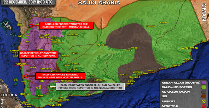
A brief overview of the recent developments in Yemen: Saudi-led forces targeted the Razih district with mortar shells; Ceasefire violations…
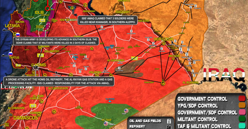
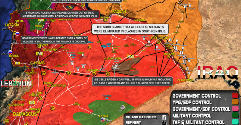
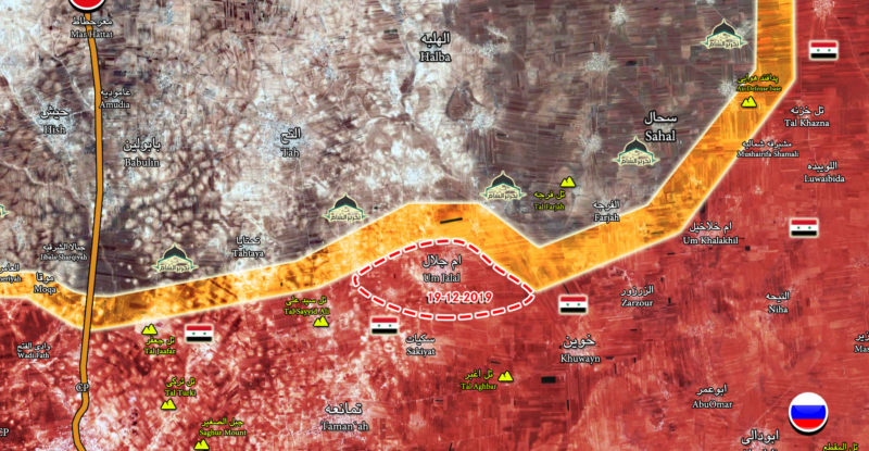
A brief overview of the recent developments in Syria: The Syrian Army is developing its advance in southern Idlib. The…
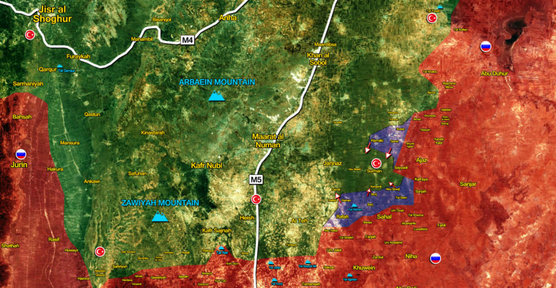
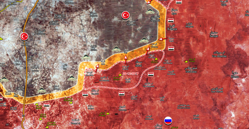
This map provides a general look at the progress of the Syrian Army advance against Hayat Tahrir al-Sham and other…
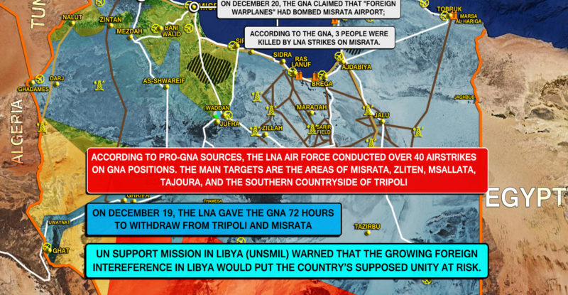
A brief overview of the recent developments in Libya: On December 19, the Libyan National Army (LNA) gave the Government…
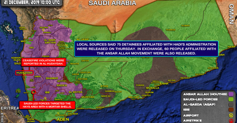
A brief overview of the recent developments: Local sources said 75 detainees affiliated with Hadi’s administration were released on Thursday….
A brief overview of the recent developments in Syria: Government forces have liberated over a dozen of villages in southern…
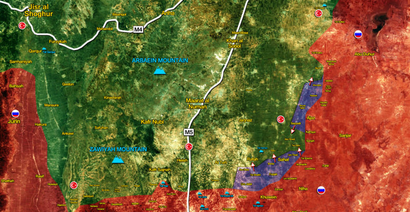
This map provides a general look at the gains of the Syrian Army in southern Idlib since the start of…
Since the start of the December 20 advance in southern Idlib, the Syrian Army and its allies liberated a number…
Late on December 19, the Syrian Army launched a ground operationagainst radical militant groups in southern Idlib. After several of…
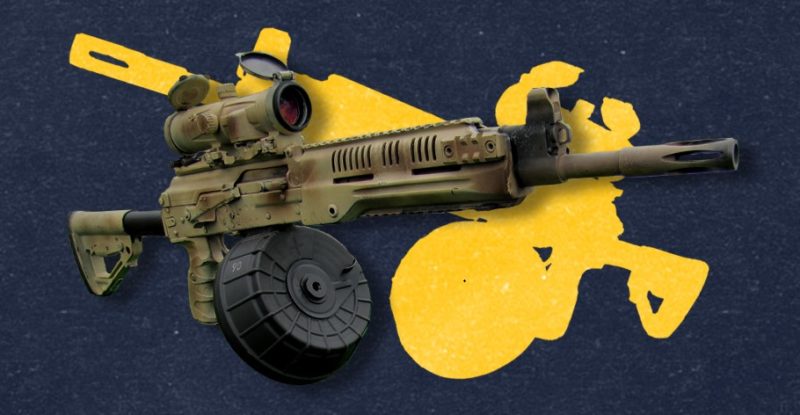
The RPK-16 is a further development of the Soviet light machine gun RPK-74. The updated design boasts an interchangeable barrel…


