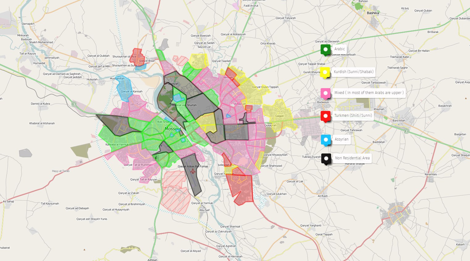
The recently released ethnographic map of the Iraqi city of Mosul, controlled by the ISIS terrorist group, explains the military developments in the area.
This week Iraqi security forces (ISF) have easily sieged the Kurdish village of Gagjali in Mosul’s western outskirts (some sources even describe Gagjali as a Mosul neighborhood, but it is not true). This sucess allowed pro-government media outlets claim a rapid success in the operation to liberate Mosul and to ‘forecast’ significant advances in the coming days. But ‘signficant advances’ have not been made.
This situation can be easily explained if somebody wants to take a look at the ethnographic situation in the city. In its propaganda ISIS aims mostly the Suni Arab population of Syria and Iraq. And Kurds are a minority among the terrorist group’s members. This is why some initial success by ISF is expected in the western Kurdish populated outskirts of the city. However, when the ISF reaches the first non-Kurdish (non-Assyrian or non-Shia) neighborhood, they will face a stiff response from ISIS.


