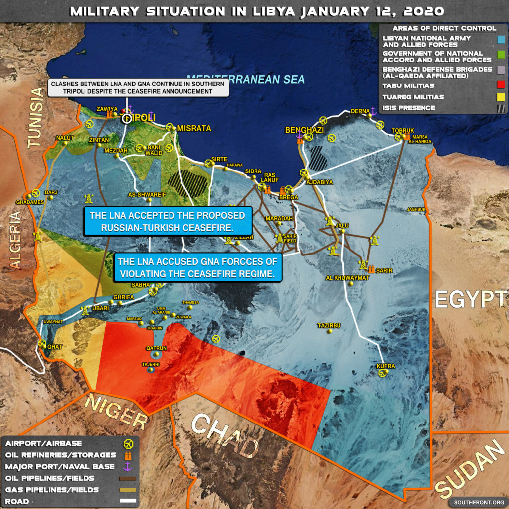
A brief overview of the recent developments in Libya:
- The Libyan National Army (LNA) accepted the proposed Russian-Turkish ceasefire;
- Calshes between the LNA and the Government of Nationa Accord (GNA) continue in southern Tripoli despite the ceasefire anoumcement;
- The LNA accused GNA forcces of violating the ceasefire regime.


The map badly outdated – still shows “ISIS presence” (hachured gray) south of Benghazi and Sirt although ISIS was totally cleared/destroyed from both areas 12 months ago. Also LNA control all country south-east of Wadi Zemzem (midway Sirt-Misrata), plus NW from Beni Walid to Tripoli south. Time for SF to re-draw colored zones ?
Rough lines of contact on my overlay for NW Libya- GNA control a large enclave around Nalut in the western Jebel Nafoosa and all areas north of the blue line: the remaining country is held by LNA and allied local militia. Note that LNA has a beachhead along the western coastal road between Zawiya and Mellitah oil/gas export terminals https://uploads.disquscdn.com/images/c5e0188e8ae883acd547c0d27418e55b52a31ef8fa2fc2b3a0a7ed09af2712ca.jpg