MIM-104 Patriot Battery positions can be identified using open source Sentinel-1 SAR Multi-temporal Imagery.
According to a report by Harel Dan, posted on October 22nd, one of the most used is ESA’s Copernicus program Sentinel 1 pair of satellites, S1A and S1B, giving a combined average revisit time of 1.5 days in a best-case scenario.
This high resolution and high revisit time, as well as open access approach, provide essential data in various fields such as emergency response, marine monitoring, vegetation analysis, wildfire quantification, and urban planning.
Furthermore, the data can be freely downloaded and analyzed on many platforms, including Copernicus Open Data Hub, Sentinel EO Browser and Google Earth Engine.
The report points out that normal optical imagery can receive interference by clouds and dust, whereas radar images can mostly “see” through water vapor and other particulate matter. However, radars are susceptible to interference from other sources of radiation on the ground and in the air. They simply need to transmit at the same wavelength.
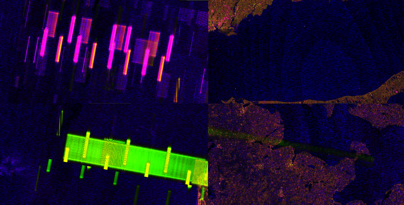
If you simply use one of the abovementioned platforms to free roam with the Sentinel-1 data you will encounter many types of interferences “blips, bloops, speckles, and waves.” The idea is to aggregate several images and thus create a smoother one, removing some, if not all of the interferences.
Examples of the interferences – Screenshots from Sentinel-Hub EO Browser
According to the report, these artifacts are the result of higher return signals. They have various polarizations, dimensions and locations. They have one thing in common – they will always have a main angle perpendicular to the satellite flight direction, thus having two distinct tilt angles based on the orbit type.
ESA, 2016
Harel Dan then attempted to correct some of the noise by using forms of image aggregation or multi-temporal analysis, where for each image pixel the lowest value is selected.
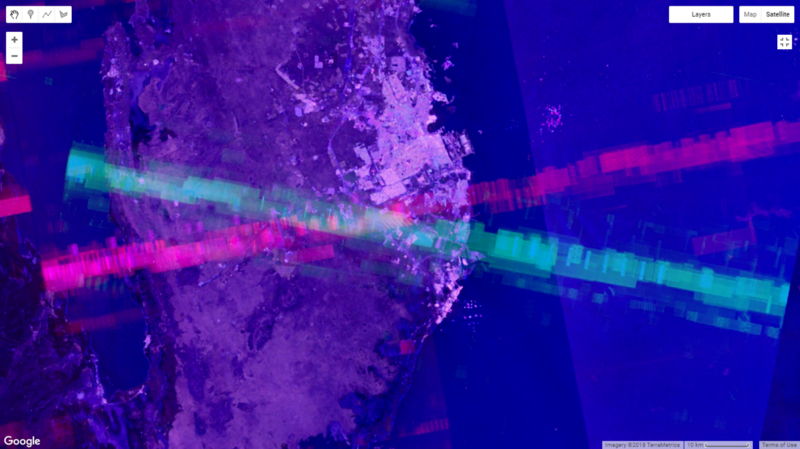
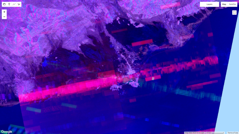
When the author used Google Earth Engine to perform the abovementioned. A combination of VH and VV polarizations were displayed. “These lines, the result of overlapping ascending and descending orbit interferences, consistently converge.”
These converging lines are AN/MPQ-53/65 phased array radars that form a Patriot missile battery C². Looking at official documentation, the military G-band is the civilian C-band. Sentinel-1 central frequency is 5.405 Ghz, well within this range.
Thus, anywhere in the world where this convergence is present there would be a patriot battery or other early warning system.
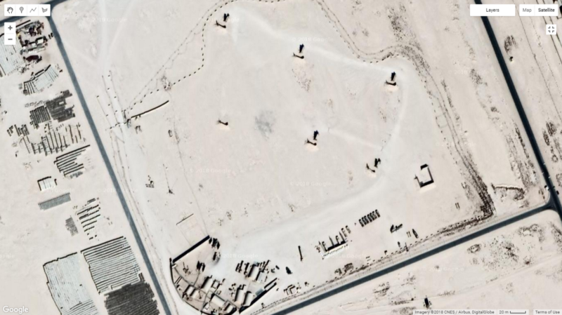
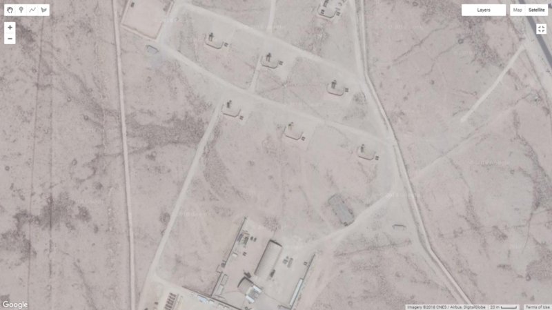
Harel Dan presented several additional screenshots from Google Earth Engine, as well as a zoom in of the convergence using Google Satellite imagery.
Ascending and Descending orbits converge over Al-Udeid Base in Qatar
Al-Udeid MIM-104 Patriot battery
Ascending and Descending orbits converge over Isa Airbase in Bahrain
Isa Airbase MIM-104 Patriot battery
There is also corroboration to the findings. Other GEOINT analysts, using the Strava Faux Pas, pinpointed Emirati Patriot deployment in Aden. This exact location is once again the exact center of the X.
Ascending and Descending orbits converge over Aden, Yemen
You can literally spend less than a minute on Stravas new data service and find sensitive sites. Nice patriot position you have there pic.twitter.com/eYS8TOuT0F
— Lost Weapons (@LostWeapons) 27 January 2018
There was also a screenshot of an Israeli patriot deployment which has since been redacted.
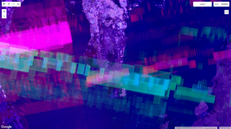
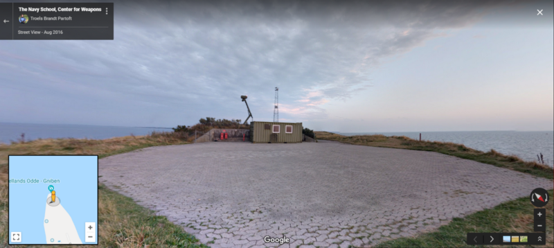
There is high confidence that these are the result of the AN/MPQ-53/65 Radar. There are, however, other sources of interference, such as the Swedish STRIL Array.
STRIL Array around Sweden
One of the STRIL locations in Sweden
All of the the above screenshots are from Harel Dan’s GEE script.
“The script collates a defined time span of images, performs the necessary filters, and displays the result. The longer the time span, the more “noise” gets added to the result, and the convergence lines become more robust. Theoretically, if you limit the time span, one could infer deployments of forces based on the time the convergence appears and disappears, give or take a few days.”
The democratization and easy diffusion of EO data is clearly presenting new challenges to organization and governments that deal in classified information.
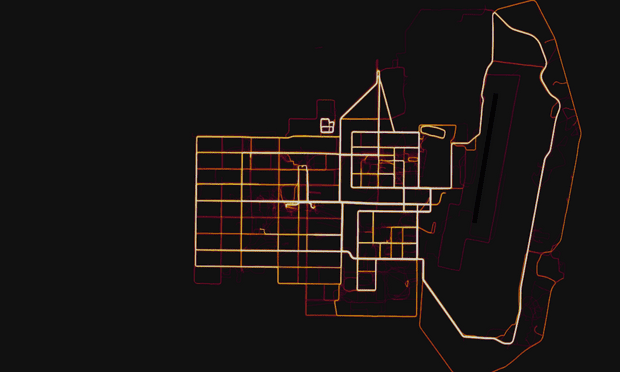
It is also interesting to note, in regard to the abovementioned Strava Faux Pas. Earlier, in January 2018, a fitness tracking app by Strava that records the movement of its users accidentally revealed sensitive information about the location and staffing of military bases and spy outposts around the world.
In November 2017, Strava released a data visualization map that shows all the activity tracked by users of its app, which allows people to record their exercise and share it with others.
Strava’s suggested solution to the military was simple: “opt out” of the heatmap and the classified information would possibly not be accidentally revealed.







a small but interesting chapter of the liberation of the truth story – truth that will bury all the hypocrites in charge today forever – the only reason to remember them as the lowest moral and ethical point ever reached by human beings.
“There was also a screenshot of an Israeli patriot deployment which has since been redacted”
ok… so it’s ok to point out the locations of patriot batteries in Qatar and Bahrain, but when it comes to Israel, Southfront gets rather shy.
The SouthFront people probably value their lives. Annoying Israel is almost asking for an ISIS bomb to be thrown through the door.
I don’t completely understand how this technology works or if it could be usable for ET/ED contact work.
I just got off the phone with the factory in China that is supposed to be building my quad track and found out that I’ve been scammed and somebody is misusing their information using a large online Chinese marketing service to generate fraudulent sales and divert the money to a big bank in Turkey. So now I’ve got to try to get my $3,000.00 down payment back.
I contacted law firms in China and the US to see if I can get some help putting together a give me my money back or go to jail deal with the scammer.
I talked with an international private investigative firm today. They asked for the case file and quoted me $1,000.00 to identify the identity thief.
They embed software into one of my outgoing emails to the scammer. And when the recipient and anyone that they forward it to opens it. It traces back to the investigation company and they can identify and locate the suspects so that the police can question them, and or a process server can serve legal papers on them for a resitution agreement for the misappropriated funds plus recovery costs.
I’m planning to use my Seek Compact Pro thermal imaging camera for my Android phone for bigfoot and ET/ED detection. I’ve already run some tests with the camera and app and there’s a wide array of filters available that are similar to the technology in the article. Bigfoots are masters of wilderness stealth, both stationary and in motion. They could have let me pass undetected 2 summers ago. But called out instead.
“In 2003, researchers at the United States Army Research Laboratory and the Federal Laboratory Collaborative Technology Alliance reported a dual band multispectral imaging focal plane array (FPA) was reported. This FPA allows researchers to look at two infrared (IR) planes at the same time.[3] Multispectral imaging measures light emission and is often used in detecting or tracking military targets. Because mid wave infrared (MWIR) and long wave infrared (LWIR) technologies measure radiation inherent to the object and require no external light source, they also are referred to as thermal imaging methods.”
– Multispectral image –
https://en.wikipedia.org/wiki/Multispectral_image
https://www.youtube.com/watch?v=ISUCp5_8JgY