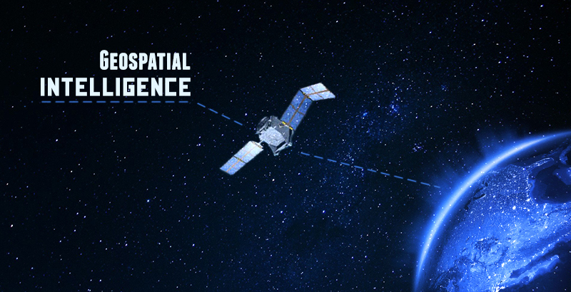
“According to a spokesman for Robert Cardillo, the current director of the US National Geospatial Agency (NGA), this system works in a way that not only seeks to attempt to access the situation as reflected at the moment in time when the most recent data was collected, but to also seek to predict what will follow.”

Written by Yoana exclusively for SouthFront
Geospatial Intelligence or “GEOINT” is actionable knowledge, a process, and a profession. It is the ability to describe, understand, and interpret so as to anticipate the human impact of an event or action within a spatiotemporal environment. It is also the ability to identify, collect, store, and manipulate data to create geospatial knowledge through critical thinking, geospatial reasoning, and analytical techniques. Finally, it is the ability to ethically collect, develop, and present knowledge in a way that is appropriate to the decision-making environment. Geospatial Intelligence doesn’t just provide the means by which to answer the questions of what?, when?, and where?, but also how?, why?, and what is the significance? Central to this proposed definition is the notion that the best geospatial intelligence resource is an educated analyst and that intelligence is about nothing if not about “out-thinking” your opponent. For all the appropriate emphasis on technologies, methodologies, tools, and infrastructure, people still are the most precious resource.
GEOINT of some kind or another is the foundation of intelligence. The data base of information has been growing since the age of computes, smartphones, and the worldwide web has come.
According to a spokesman for Robert Cardillo, the current director of the US National Geospatial Agency (NGA), this system works in a way that not only seeks to attempt to access the situation as reflected at the moment in time when the most recent data was collected, but to also seek to predict what will follow.
It may be hours or days old or even collected years ago but the majority of information will be inevitably be connected. The objective is to combine and integrate the most recent information and prior intelligence so as to offer a current determination of circumstances and a reasonable projection of what is or will be happening.
The Intelligence Community sees geospatial information (everything that can be seen or known about the Earth its occupants, and features both natural and manmade) as a tool to assess geogra-phically referenced activities on Earth. The analysis requires correlating and integrating data from multiple sources. No single source can do it all. The final product is intended to be intelligence that can answer questions. Some can be simple such as ‘Where am I?’ or ‘What does an area look like and how might it change given various influences?’ For example, is the nature of a particular geographical area such that it might flood in a storm? Other questions may require deeper analysis and introspection: ‘What are the probable courses of action that an enemy might take against one’s deployed forces?’
The first step in the process is the collection of the data used to outline the parameters of the task and to fill the gaps in the current information. This is the GEOINT product and it is expected to be further developed.
The next thing they do is to analyze the current situation and to obscure the factors that may influence on it. When this is done, it is very important to connect the dots and assess the information- combine it, compare it, relate it. Through this is possible to get information for instance for the order-of-battle; size and strength of the enemy or threat; enemy doctrine; the nature, strength, capabilities and intent of area insurgent groups; effects of possible chemical/biological threats. This of course is related to collaboration with national security community counterparts.
After it is analyzed, it has to be distributed to those who need it in a timely manner. Doing this, is usually the biggest challenge. Passing information through ‘channels’ is out of step with the increasingly rapid transition of events that occurs. The delays inherent in this approach too often mean the intelligence either may not reach those who require it or that the opportunity to take action to favorably influence the situation is lost.
The collection mediums for GEOINT have generally reflected scanning the electro-magnetic spectrum for high-resolution colour imagery, radar, infrared, laser, hyper-spectral and full motion video. Before, this information was controlled and often restricted by governments and military, but now we are witnessing a rapid change. The US NGA has acknowledged that what its director calls a “seismic-shift” is occurring where open source and commercial information will dominate and far expand the data available.
Now, this information delivery is in the hands of private sector GEONIT providers. Within the next few years an immense network of small satellites will be put in place by private sector GEOINT providers. This has the potential of providing 24-hour, seven-days-per-week, 365 days-per-year continuous coverage of the Earth, something current government platforms are not capable of.
This seismic shift is driven by the increasing number of users of GEOINT and recognition of its value. A notable example was highlighted by Mr. Cardillo at the recent GEOINT Foundation Symposium held in late-June in Washington DC, describing the NGA’s support to the Ebola response in Liberia. Here, intelligence helped place treatment units and determine travel times and routes from places where breakouts occurred. But what made it work was that “our GEOINT contributions were posted on the World Wide Web,” Mr. Cardillo told the symposium. “With no accounts, no passwords and just a web browser, this allowed health care workers to quickly isolate those with the virus, and shortened times between diagnosis and treatment. That time-saving led to life-saving.”
In the future, this program is expected to no longer be efficient in decision- making, planning or taking actions since it cannot be controlled any longer which will lead to its inaccessibility, irresponsiveness, and its insufficiency.
The problems that the system will have to face is the fully leverage non-traditional sources, especially open ones, and integrate them in continuous, real-time analytics since there is going to be developed a multi-resource system. Data must be filtered to pick-out and tag events of critical importance and cue them for analysis within minutes of collection. Finally it must provide rapid decentralized dissemination to all affected and actionable parties in a form that can be utilized.
Dr. Pavel Malachek, founder of Spaceknow a GEOINT provider, suggests that the true benefit will be in the transition from “big data to fast data”, effectively accelerating “from data to answers”.
The goal he indicted is, in SpaceKnow’s case, “to make satellite imagery something that needs to be and can be used every day.”
The US NGA has taken initiatives to implement broader access to its capabilities. In fact, much of its data is already in use by the public such as in air and maritime safety and navigation and US Geological Survey (USGS) maps. However, its Map of the World, introduced in 2014, is becoming the platform for intelligence integration and an integral component of its shift towards open GEOINT.
The difficulty of coordinating information and GEOINT across the many partners and customers is also being addressed in the fielding of the ICITE (Intelligence Community Information Technology Enterprise). ICITE is a desk-top based common computing environment using cloud technology designed to provide for smooth information flow across a range of US agencies.
GEONIT may help a lot in disaster response, to industry, agriculture, urban planning and a wide range of disciplines outside defense and national security. The solution to key intelligence questions requires maximizing the integration of available information sources. The growth in the data amount will probably help a lot in the automation of data collection and cataloguing. The introduction of the vast array of small satellites and inevitable expansion of public and digital media will simply accelerate this trend.
Yoana
SouthFront


