Pro-Kurdish sources have been spreading reports that US-backed Syrian Democratic Forces (SDF) have captured a significant part of the Tabqa dam in the Syrian province of Raqqah.
The Tabqa dam is an important site at the Euphrates in 25 km west of Raqqah and has a big strategic value. The site supplies electric power to a wide area of Syria. Retaking the dam is considered as a vital step in further isolating the ISIS self-proclaimed capital of Raqqah and reducing the terrorist group’s influence in the province.
However, the claims of pro-Kurdish sources almost have not been confirmed by photos and videos from the area (you can find available info here).
The most important “evidence” of the SDF’s presence in the area of the Tabqa dam was releaed by the SDF Press Center on March 23.
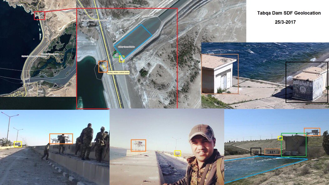
SDF positions shown at the video were geolocated by media acvivists interested in the Syrian conflict:
Geolocation of all SDF pictures taken at Tabqah dam so far, by @MidEastFollower – SDF controls northern part of the dam, no evidence of more pic.twitter.com/DnAg31ftmW
— PurpleOlive (@PurpleOlive2) March 26, 2017
Thus the video confirms that the SDF reached and controls only a northern part of the dam. There have been no additional evidence of SDF advances in the area yet.
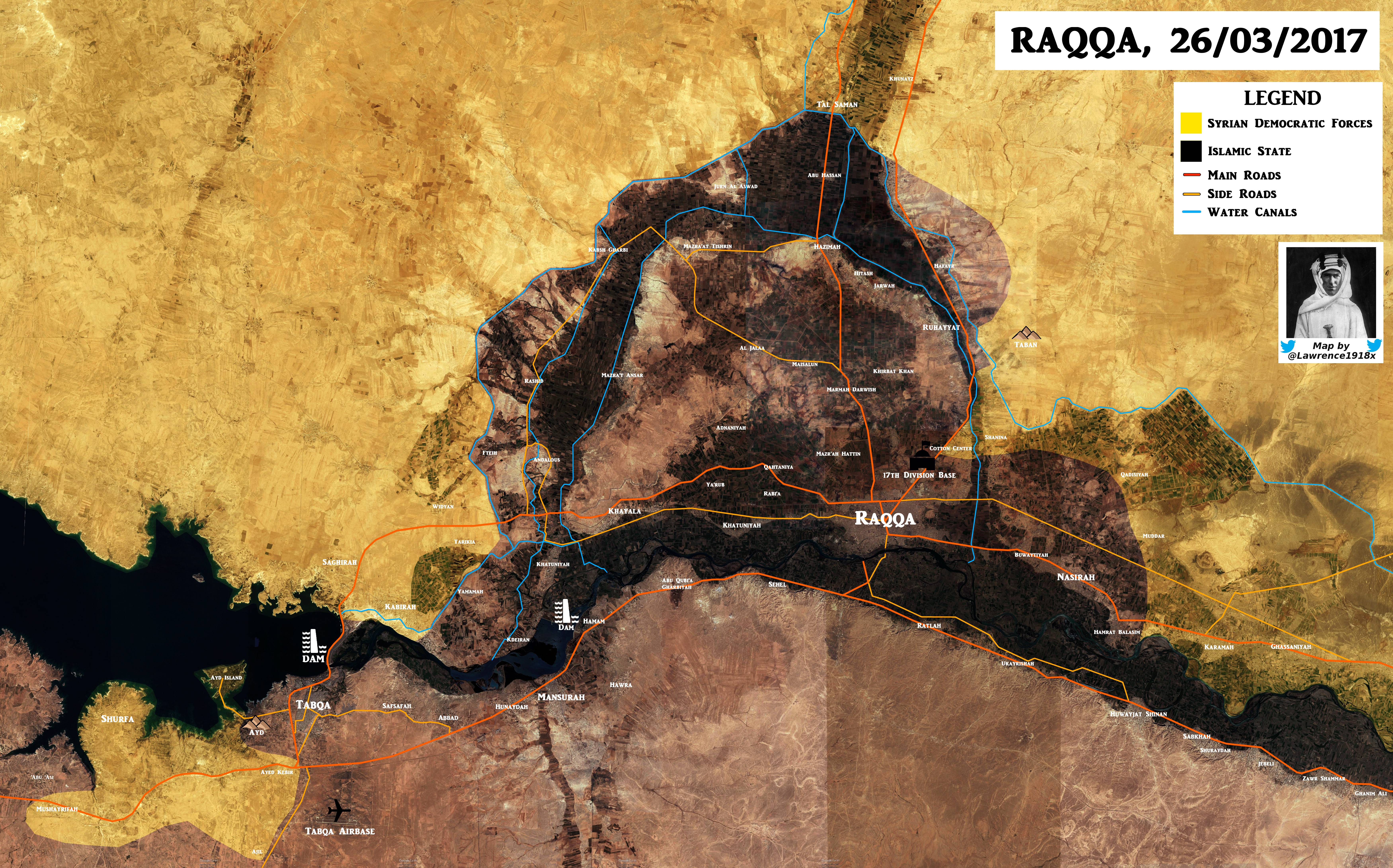
The map below shows the military situation in the area of Raqqah on March 26, 2017. On March 25, reports appeared that the SDF entered the Tabqa Military Airport and even captured it from ISIS terrorists. This still has to be confirmed by some videos or photos from the area.


